The State of
Following is
a list of Maine-specific or Maine-related internet sites containing information
presented as a map or maps. These are organized by thematic content and
include both scanned static maps and dynamically rendered data provided through
a wide array of technologies. Sites included in this list do not
generally require additional technology or viewing software and are presented
for quick and easy access. This list does not emphasize sites supplying
raw GIS data or map services hosted for processing by GIS professionals.
This site is
presently being maintained by Reference
Standard, in cooperation with the Maine GeoLibrary
as part of ongoing statewide geospatial planning in the State of
To report
broken links or to submit additional sites for inclusion, please email rs@restmap.net
Updated: 03
January 2008
agriculture | demographics | economic
development | emergency management | environment |
facilities +
recreation | general reference | health | historic | imagery | marine |
municipal | transportation | utilities
| weather |
STATISTICS
CropMAP Series of maps at state
and county levels describing ecoregions and hardiness zones. Also contains county by
county statistical data in tabular form. Service of
Crop Map Time Series. Department of Agriculture Census / COA, 2004 [offline 2007.1220]
Maine Census of Agriculture, 1997. Land in Farms, Market Value of Ag Products, Selected
Crops Harvested. By County (pdf)
AGRI PESTS + INFESTATIONS
Data from National Agricultural Pest Information System
|
|
|
|
||||||||||
|
|
|
|
|
|
|
|
|
|
|
|
||
|
|
|
|
|
|
||||||||
|
|
|
|
||||||||||
|
Potato Mop Top Virus |
|
|
|
|
|
|
|
|
|
|
||
|
Potato
Virus |
|
|
|
|
|
|
|
|
|
|
|
|
|
Soybean
Rust |
|
|
|
|
|
|
|
|
|
|
||
|
|
|
|
|
|
|
|
|
|
|
COMMERCIAL
Maine
Farmers Markets Map Shows locations of all farmers markets in
Locations of Organic Farms
| National map from USDA; includes downloadable .kmz data
US CENSUS
108th
Congress and Municipality type map (pdf) | depicts
municipality types – incorporated places, tribal areas, national park service
land;
US CENSUS
VIEWER
TIGER
data (1998) display and query through a webmapping
application. During business hours this application is too slow to be
useful.
HOUSING,
REGULATED SITES
HUD Homes and Communities Application ; seems to be finicky
and IE-dependant;
MUNICIPAL
DATA + MAPS
City Data Viewer | a somewhat
chaotic collection of links and maps organized as individual towns and
cities; contains housing and population
data as well as crime, weather, cultural, educational and other data. Major municipal categories are cities over 6,000, 1000-6,000, and under 6,000. Sample: Augusta
SEDAC - CIESIN CENSUS VIEWER (1990
Data)
US Census data
from the Columbia University Center for International Earth Science Information
Network and the SocioEconomic Data and Applicatons Center at NASA.
http://plue.sedac.ciesin.org/plue/ddviewer/ddv20/htmls/map-intro.html [offline 2007.1220]
SCHOOL
DISTRICTS Demographics Mapping:
STATUS:
2007.1220: poorly performing and antiquated; mapserver
type and source unknown;
http://maps.nces.ed.gov/sddsgis/mapsviewerusa.asp?focus=onestate&state=23
Tourism / Vacation
Maine Office of Tourism
interactive map | statewide Flash map presentation
Downeast
Scenic Rail Route |
Route map of heritage rail project (PDF | 3.5 MB | 2007)
http://megisims.state.me.us/website/e911stat/viewer.htm
Town
Resources Viewer
Viewer for locating Emergency Management Offices and critical
facilities/sensitive receptors statewide. Includes fast and attractive
printing format.
STATUS: 2007.1220:
loads fine, selection by town fails
http://musashi.ogis.state.me.us/mogis/html/Y2Kmap-New.htm
AIR
QUALITY MAPS
Directory of EPA
current and archived maps of air quality, ozone and forecasts; Sample:
Facility Emissions
AIR
QUALITY (OZONE)
Maine DEP clearinghouse site for air quality in the state. Links to
many other weather/air quality locations.
http://www.state.me.us/dep/air/ozone/
ATMOSPHERIC
DEPOSITION
National Trends
Network monitoring site for, among other things, Mercury concentrations in
rainwater falling on
BEGINNING
WITH HABITAT
Habitat-based map series describing water resources + riparian habitats,
high value plant + animal habitats, and undeveloped habit blocks for Maine
towns.
BIOREGIONS
and CONSERVATION LANDS
The Nature
Conservancy map and analysis products.
http://gis.tnc.org/data/MapbookWebsite/map_page.php?map_id=33
http://gis.tnc.org/data/MapbookWebsite/map_page.php?map_id=35
http://gis.tnc.org/data/MapbookWebsite/map_page.php?map_id=43
The
Nature Conservancy Internet Map Server: Contains parks, managed areas,
eco-regions etc for US including
Wilderness
Society OIK/OS Conservation/Development Tool.
A simple ArcIMS application with basemap layers, parks and federal
lands. [offline 2007.1220]
EPA ENVIROMAPPER
ESRI ArcIMS
application for viewing various superfund, water
discharge and other activities.
Locate by zip code.
GEOLOGY
Beach +
Dune Geology | Bedrock
Geology | Bedrock Groundwater | Coastal Bluffs | Coastal Landslides | Earthquakes
| Inner
Continental Shelf | Lakes | Sand and Gravel Aquifers | Surficial
Geology; | Surficial Materials
INVASIVES
Invasive Plant Atlas of New England. Use the Search By Place
query to display field records of invasives.
LAKES
INFORMATION
STATUS: 2007.1220:
loads but buggy and ostensibly unmaintained
UMO PEARL
Project. Access to
information on over 5700
LAND
COVER and VEGETATION
Land Cover of Maine project by the
Maine Image Analysis Lab at UMO. Static maps depicting
agricultural and forestry information by municipality (1993-)
Static maps
describing
http://www.ume.maine.edu/~MIAL/maine_cd/second_page/land.htm
LAND
COVER and CHANGE ANALYSIS
Penobscot
Bay Watershed Towns: Innovative change analysis presentation showing 1986 -
1993 change.
http://www.csc.noaa.gov/products/maine/html/townsel.htm#maps [offline 2007.1220]
LAND
TRUST NETWORK TRUST LOCATOR
Maine Land
Trust Network applilication
for identifying operating areas of trusts in
http://www.mltn.org/ltmap.html [offline 2007.1220]
LAND TRUSTS: KENNEBEC LAND TRUST
PROPERTIES
map of
properties (image in htm page, 2006)
LIGHT
POLLUTION
Mount
Desert Island, College of the Atlantic; methodology
PRECIPITATION MONITORING NETWORK (USGS)
http://me.water.usgs.gov/precip.html
REGULATED
FACILITIES, WATER RESOURCES
US EPA Enviromapper. Many options
for various thematic presentations. Mapping includes Brownfields, Watersheds, Superfund sites, and others.
Not a very dependable site.
http://www.epa.gov/enviro/html/em/
RIVER
INFORMATION
http://www.erh.noaa.gov/nerfc/
WATER
(GROUND) NETWORK (USGS)
http://me.water.usgs.gov/gwnet.html
WATER
(SURFACE) NETWORK (USGS)
http://me.water.usgs.gov/swnet.html
WATER QUALITY
MAPS (Maine Department of Environmental Protection)
http://www.state.me.us/dep/blwq/mdepmaps.htm
WATERSHED
(
PEARL ESRI ArcIMS service depicting all watersheds in
http://pearl2.spatial.maine.edu/website/pearlmaptest/viewer.htm
WATERSHED
(
WATERSHED
(
http://sposerver.nos.noaa.gov/projects/gomaine/EDA_MAP.html
WATERSHED
(Presumpscot)
NASA/UCONN/Nautilus:
http://resac.uconn.edu/website/presump_allfile_hv/viewer.htm
[offline 2005.04]
http://resac.uconn.edu/maps_data/study_watersheds/maps_dataME.html
[offline 2005.04]
WETLANDS
(National Wetlands Inventory) Mapviewer
ArcIMS
area query page. Slow ArcIMS response times, but interesting information
once it comes up. Best used off peak hours (nights and weekends).
http://ecos.fws.gov/nwi_mapplet/
Hunting
Moose
Hunting (Selected Wildlife Management) Districts
Inland Fisheries and Wildlife clickable map of moose hunting regions and details
BAsiInland Fisheries and Wildlife clickable map of spring turkey hunting areas
Wildlife Management District Maps
Directory of
Parks, Public Reserved Lands and
Historic Sites
Department
of Conservation clickable map-based index (DOC secondary links DEAD August, 2002)
http://www.ume.maine.edu/~MIAL/maine_cd/tertiary_page/land/map.htm
(UMO Mirror)
Department
of Conservation, Bureau of Parks and Lands individual park maps:
From University
of Texas Map Library:
OUTDOOR
ADVENTURE GUIDE
Hillshade with points of interest information; Hosted
by I-Map out of
Recreation
Snowmobile Trail Maps Directory
of
National
Geographic Map Machine
Early testbed of webmapping by
cartographic giant, National Geographic. A little bit dated by the end of 2003.
College of the Atlantic: Map Gallery
Various thematics hosted by the COA, many
relating to
National Atlas
Collaborative
undertaking of the US Dept of the Interior (USGS), ESRI begun in 1997. Small (1:2,000,000) scale data.
http://nationalatlas.gov/natlas/natlasstart.asp
NOAA Nautical Charts
Harvard
University Engineering: Scanned NOAA charts of
University
of Maine – Fogler Library
Geostats
Spatial, Socioeconomic and Natural Resource Data Service; map services and data; primarily from MEGIS
UT PCL Library
Maine-specific maps in the
extremely useful
http://www.lib.utexas.edu/maps/maine.html
Federally Designated Mental Health Professional Shortage Areas
MeGIS
Federally
Designated Medically Underserved Areas and Populations MeGIS
Federally Designated Primary Care Health Professional Shortage
Areas MeGIS
MAINE
1860: Historical Scan
MAPS and
PANORAMAS
Index to
high resolution scanned images from the LIbrary of
Congress. Includes numerous historic maps that can be
viewed through a browser or downloaded as large MRSID format. Type
http://memory.loc.gov/ammem/gmdquery.html
Interactive
maps of the state and individual town landscapes.
MAINE
1799: Osgood Carleton
Augusta
1823: Cyril Searle, oblique landscape
Hallowell
1794: Ephraim Ballard
Hallowell
1878: A. Ruger, birdseye view
NOAA Scanned Coastal Image Repository
Click link
and type in
http://historicals.ncd.noaa.gov/historicals/histmap.asp
Quad
Index, Historic Dimond Library, UNH
Historic topographic maps for New England available as images. Incluedes
maps of NH, CT, MA, RI, VT, and NY
http://docs.unh.edu/nhtopos/nhtopos.htm
AERIAL
& NAUTICAL CHARTS
Maptech Mapserver: Free
aeronautical, nautical, topograhic and ortho imagery where available (
COASTAL
AERIAL PHOTOGRAPHY VIEWER
Department of Marine Resources Planning and Response tool.
http://www.state.me.us/dmr/aerialphotos/
GOOGLE
SATELLITE IMAGERY
Google Maps
with satellite imagery option. Imagery data are fairly coarse for
ORTHOPHOTOGRAPHY
TerraServer:
Commercial orthoimagery of
TerraServer-USA:
Original Microsoft-built and SQL Server
powered site for delivering free USGS imagery for the
US; when originally launched in 1998
this provided revolutionary data access, but in the past decade the split with
TerraServer and more importantly advances in hosting/distribution technology
have made this something of an artifact; relationship between TerraServer + TerraServer-USA described here;
USGS Internet Map Server
http://geonames.usgs.gov/pls/gnis/web_query.gnis_web_query_form
USGS
QUADRANGLES
TopoZone:
Topographic Maps of the entire state (and USA) at multiple scales. Includes direct links to trails information.
http://www.topozone.com/findresults.asp?place=&statefips=23&placesearch=Search
Direct link
to Baxter State Park
Drug
violations per county;
Metro
Areas; FBI Uniform Crime Reporting, University
of Maine, Margaret Chase Smith Policy Center; Rural Substance Abuse Program Map Index
Gulf of
Main Mapping Portal: Includes
current/recent information on numerous ocean and atmospheric condition variables
Gulf of
Gulf of
Maine Watershed Map (HI RES) LO
RES
Gulf of
Maine Atlantic Herring Stocks
MARINE
Guide to all
harbors on the
http://www.coastguides.com/r5/r5.html?http%3A//www.coastguides.com/r5/5.61Somes.html
MARINE
RESOURCES ATLAS
Island Institute E-Atlas. Includes information on Groundfish, Herring and Lobster habitat.
http://atlas.islandinstitute.org/findamap/interactivemaps.asp?section=introduction
PENOBSCOT
BAY PROJECT
Puffin
Study
Research Areas Index,
Audubon Project Puffin
NATURAL RESOURCE DAMAGE ASSESSMENT
Julie N Oil
Spill,
http://www.state.me.us/dep/rwm/JulieN/story3.htm
NOAA Nautical Charts
Harvard
University Engineering: Scanned NOAA charts of
WATERSHED
(
http://sposerver.nos.noaa.gov/projects/gomaine/EDA_MAP.html
Auburn
General Purpose Municipal GIS (CDM)
Bath
General Purpose Municipal GIS (DeLorme)
Brunswick
General Purpose Municipal GIS (Woodard+Curran)
Carrabassett
Valley Tax Mapping System, Including Sugarloaf Mountain
(BeyondGEO)
Ellsworth Municipal Viewer, ArcIMS [offline Spring2005]
Falmouth GPCOG Parcel Viewer (Spatial
Alternatives)
Lewiston GIS Viewer
and access to published maps (CDM)
Lisbon
Norway
Town of
Paris
Town of
Saco Municipal
Website (Woodard+Curran)
Sanford/Springvale
Municipal Viewer (Woodard+Curran)
Southwest
Harbor, MDI, College of the Atlantic GIS Lab, Zoning and Other
Resources
Waterville
Municipal Viewer. Parcels, footprints. (BeyondGEO)
.
Westbrook
General Purpose Municipal GIS (Woodard+Curran)
York
General Purpose Municpal GIS (CDM)
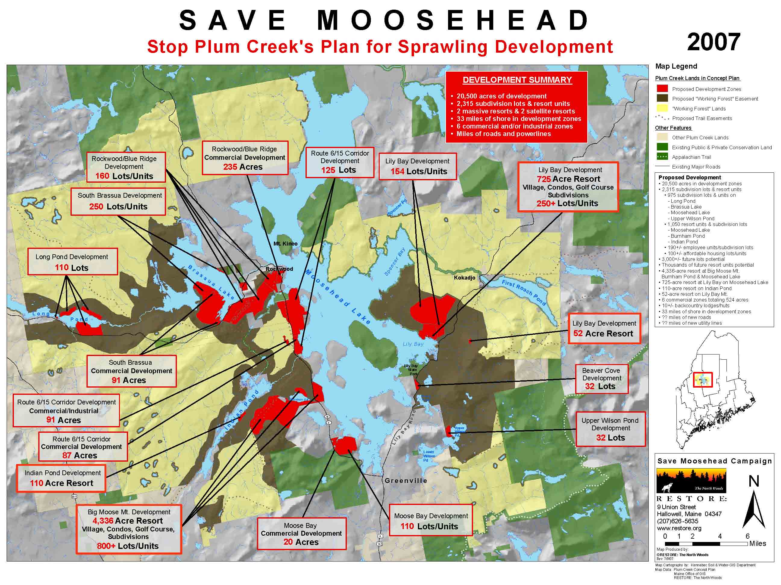
Moosehead
Lake Region | Proposed Concept Plan
LURC Materials | NRCM
Alternate Plan | GrowSmart Maine Plan | Nature
Conservance Framework | RESTORE
Plum Crk Interpretation |
Department
of Transportation
http://65.82.158.251:84/default.asp?display=all&area=ME_statewide&date=&textOnly=False
CORRIDOR
STUDY PLANNING
DOT
I395 / Route 9 (
http://www.i395-rt9-study.com/
Androscoggin Road
Classification Map (
Aroostook
County I-95 Extension (VHB)
Map: http://www.vhb.com/aroostook/maps/preferred%20corridor.pdf
Study: http://www.vhb.com/aroostook/Corridormap.htm
GOOGLE
maps
Maine
Overview with the default mapping option.
MAPQUEST
Industry
standard transportation/navigation web mapping.
MICROSOFT MapPoint
Very fast and consistenly improving map server
for roads and navigation. No background imagery or thematic layers.
Bar
Harbor – Acadia direct link
Maine Turnpike
Authority maps of I-95 and exits
http://www.maineturnpike.com/html/maps/turnpike_map.html
Straight
line distances between prominent
http://www.state.me.us/mdot/mainhtml/mileage.htm
[LINK STALE 09/2003]
Regulated
Utilities Service Areas HiRes
ELECTRIC
Central Maine Power:
Bangor Hydro:
ISO New England: Maine
& New England real time electric power market electricity costs
NATURAL
GAS
Maine Natural Gas: Approved
Service Areas
NORTHEAST
US WEATHER CONTENT
Links to large number of maps
and images relevant to Maine + Northeastern US weather
REAL TIME
and LOOPS
Intellicast Weather Loop: Dynamic current weather
display. Includes links to many additional weather display variations
NOAA
Experimental Weather Viewer Northeast Maine | Southwest Maine
Snow
Forecast
Northeast Ski Area Weathermaps (BestSkiWeather)
StormWarnings
http://stormdisplay.weatherbug.com/warnings.asp
Surf Info (wave
heights) Interesting little viewer that provides wave information at
24-hour intervals out to 6 days.
Daily
Weather Maps (Northeast US)
Large collection of (rather arcane) weather maps for
Main Page: http://www.ems.psu.edu/wx/automet2/surface/current/
Surface
Conditions; Surface
Temperature: Surface Wind
DROUGHT
WATCH (USGS)
http://me.water.usgs.gov/droughtme.html
ICE
STORM, 1998
SNOW
COVER
http://www.state.me.us/mema/weather/snow.htm#map1
SNOW
DEPTH
NOAA National Weather Service snow statistics pages. Part of River Information
network.
SNOW PACK
MONITORING NETWORK (USGS)
http://me.water.usgs.gov/snownet.html
WIND
POWER POTENTIAL
Part of the
Wind Energy Resource Atlas of the United States.
http://rredc.nrel.gov/wind/pubs/atlas/maps/chap3/3-22m.html
http://www.bergey.com/Maps/ME.Wind.htm
Some of the
above and additional Maine Internet mapping links may be reached from the
following clearinghouse sites:
Maine.GOV
Map
Directory
Thematic Maps | good sampling
of interactive and publication-compiled map products from MEGIS. Some high quality stuff
here. Check out the Maine
Atlantic Salmon Habitat Atlas.